
Tarragona is a port city in northeastern Spain's Catalonia region south of Barcelona. Lonely Planet calls it "effervescent... where Roman history collides with beaches, nightlife and a food scene that perfumes the air with freshly grilled seafood." Well, maybe. True, many ancient ruins remain from its time as the Roman colony of Tarraco. And yes, the knot of lanes in the medieval center offer a splendid excuse for wandering. The city's relationship to the Mediterranean is, at best, complex. The ruins - a UNESCO World Heritage List site - are there, a bit scattered and, as yet, not particularly well-explained in the context of the entire city. And the food? Not much better or worse than the rest of Spain.
What actually makes this city of 132,000 people fascinating is that aside from its rich history, it is actually a working city with not only a port, but major oil storage and refineries, financial and business zones, and the commercial infrastructure that augment all of this activities. It also has its own brand of entertainment and to my delight, street art. A great place to visit that is not, truly yet, a tourist center.
(A language note: The official co-language of Tarragona is Catalan. At various points below, I use Castilian, Catalan - or both - to identify specific landmarks and activities. I like to think that this is in keeping with the linguistic stew of Spain. And yes, I realize that regardless of which language, there are some accents and tildes missing.)

STREET SCENES


A very narrow, tall building, probably of interest only to other architects...
although certainly not for its aesthetics.


Clearly, more thought was put into this fabulous emergency exit staircase
than to the building itself.

Intriguing addition(?) to what?


Ajuntament de Tarragona (City Hall) on the Placa de la Font.


THE UNEASY RELATIONSHIP
WITH THE SEA

Even in this tourist view of the city I photographed, the slightly discordant note of the oil tanker in the distance - replaced soon after with another and then another - speaks to a reality that is clearly not the idealized vision of our preferred relationship with the sea.

Another idealized view....but on the other hand....

This panorama view (by others) shows the reality of the relationship between the city's core and the Mediterranean. There is a highway at the base of the cliffs on which the city itself is built. At some point, the railway that tied the country together expropriated a parallel tract of land to build multiple tracks along the seafront that are the main north-south lines for the country's Mediterranean coastal cities and that feed Tarragona's main railway station,. On the other side of the railway tracks, another parallel road was built. Finally, there is the sandy beach or (in the upper distance), the new-ish "yacht" harbor.
The problem is getting to the beach from the city. Ancient stairs that have been modernized over the years take you from the promontory to the roadway. But to get across the tracks and the other roadway to get to the beach you have to walk way beyond and inland from the railway station, walk through a long underpass and then, essentially, re-trace your steps along the second roadway. Clearly, a major pedestrian overpass is long overdue: an international design competition if I have ever heard of one.

As if the physical and visual clutter were not enough, here on the road closest to the beach, massive guardrails have been placed down the center of the highway to divide the two directions of travel. Note the attempt to create a ornamented seaside promenade a la Robert Burle Marx's incredible walkways in Rio de Janeiro, or ever closer to home, the beach promenade in Alicante - see previous blogs. The attempt is to be commended; the result, not so much. In the distance the city's land mass juts into the Mediterranean. Not sure what development is like there, but it appears to be a good example of living on the "right" side of the railway tracks.

On one of the no-man's land created by the only somewhat parallel roads and train tracks, the city is attempting to develop some contemporary urban landscape that affords views to the sea. The highly questionable attempt at an office building above (where, I presume, the designer thought it would be interesting to try to give everyone a corner office) was dumped on the center of the site and then surrounded by asphalt to provide some helter-skelter parking. A piece of sculpture - the white thing to the right - completes the ensemble. From this vantage point within the property lines, it is clearly just as bad as the majority of buildings today. Unfortunately, the view of the building and the surroundings from most everywhere else is much more like in the photo below and make the total endeavor seem even more hopeless.

THE ARCHAEOLOGICAL ENSEMBLE OF TARRACO
"The Archaeological Ensemble of Tárraco is located in Tarragona, in the Autonomous Region of Catalonia, in the northeast of the Iberian Peninsula. The city of Tárraco was the first and oldest Roman settlement on the Iberian Peninsula and capital of most of the peninsular territory, the province of Hispania Citerior. It was a major administrative and mercantile city in Roman Spain and the major centre of the Imperial cult for all the Iberian provinces. Tárraco was endowed with many fine buildings, and archaeological excavations have revealed parts of the Roman settlement from the foundation of the city in the Republican period (3rd century BCE) to the Early Christian Era.
The serial property encompasses a total area of 32.83 ha and is comprised of the Roman city of Tárraco, the present day city of Tarragona, and a number of elements within the surrounding territory: Roman walls, the Imperial cult enclosure, the Square with representation of the provincial forum, the Circus, the Colony forum, the Roman theatre, the Amphitheatre, the Visigoth basilica and Romanesque church, the Early Christian necropolis, the Hydraulic conduits from Tárraco to Les Ferreres aqueduct, the Tower of the Scipios, the Mèdol quarry, the Centcelles villa and mausoleum, the Els Munts villa and Berà Arch."
(From the UNESCO World Heirtage Listing)

AMFITEATRE DE TARRAGONA
(The Roman Amphiteater)
An oval structure built in the 2nd century overlooking he sea, its stands (seats) were carved directly out of the underlying bedrock. The amphitheatre is 109.5 metres long by 86.5 metres wide and hold up to 14,000 spectators. In its day, it was the scene of fights between gladiators and against wild beasts, as well as public executions. In the year 259 A.D., the Bishop Fructuoso and his deacons Augurio and Eulogio were burned alive within its confines. In the early 6th century, a Visigoth basilica was built on the site, which was eventually replaced by the medieval Santa Maria del Miracle (Our Lady of the Miracle) church.
(www.tarragonatourisme.cat)


The inner oval shape in the plan above is the original open space/arena of the amphitheater, surrounded by the tiered seating, only some of which remains. The inverted "T" in the plan is a now open excavation that reveals the below-ground "preparation" areas. To the right, the cross-shaped object is the location of the remains of the Visigoth basilica and medieval church that were built within and on top of the Roman amphitheater. All of these elements create a complex archaeological site that, frankly, is difficult to grasp at first-sight. The Visigoth basilica dates to the 3rd century AD, and the church to the 12th century, so from a historical perspective this encroachment is almost as important at the original amphitheater itself.

One of the original grand entries into the arena.


Looking towards the remains of the basilica and church (upper center of the photograph). Directly in front and ahead, splitting the site, is the exposed lower level.

The tiered seating, some of which has been newly stabilized.

Crossing over from the amphitheater into the remains of the basilica and church.

The remains of the walls of the basilica and church.
CIRCO ROMANO DE TARRAGONA/
CIRCUS ROMA
(The Tarragona Roman Circus)
Located between Via Augusta and the provincial forum, Tarragona's circus was once used to hold horse and chariot races. An elongated structure measuing 325 by 115 metres, its original capacity has been estimated at 30,000 spectators. The complex was built in the 1st century (probably under the Emperor Domitian). Unusually, it was located with the city limits and is thus endowed with several atypical architectural features. It is considered one of the best-preserved circuses in the West, although some of the original structure remains hidden under old 19th-century buildings.
The Praetorium is a Roman-ear tower that once housed the stairs that connected the lower city to the provincial forum by way of the circus, to which it is connected by means of underground passageways (which were also used to service the games at the Circus). It stands at one of the corners of the vast rectangle of the provincial forum square. In the 12th century, it was transformed into a palace for the monarchs of the Crown of Aragon. It was subsequently used as a prison. (Today, it is the City's historical museum.)
(www.taragonanaturisme.cat)

The Circus was a vast structure. The grey oblong overlay (in this photo by others) shows the extent of the building. To get a better sense of the scale, below is the only remaining portion of the Circus. The tower you see (a medieval addition) is located at the very lower right-hand side of the above photograph. Surprisingly, the Circus was still in use up until the 5th century AD when it was finally abandoned. The fact that the Circus survived almost intact until the 19th century is remarkable and, at the same time, sobering - how little regard was paid to in the thrust for urban development.


(Photo by others.)


The underground passageway connecting the Circus with the Praetorium. A series
of large rooms/chambers/holding cells(?) line the passageway (one doorway can be seen on the left-hand side of the photo).
Praetorium

A contemporary vertical circulation element (an elevator) has been inserted into the center of the Roman tower. It pierces the roof of the tower in, what I believe, is an interesting visual juxtaposition that does not detract from the overall gravitas of the building. Once lifted to the top (or having walked up by an equally nifty contemporary staircase), the views of the Mediterranean and the city are spectacular.


The interior and adjacent exterior spaces of the, now, history museum are a fascinating backdrop for the exhibitions.


A roman emperor...

...surveying the oil tankers.

Close-by the historical museum is the Museu Nacional Arqueologic de Tarragona (MNAT), (The National Archaeological Museum of Tarragona).
FORUM DE TARRACO
(Colonial Forum of Tarraco - Also known as the Basilica)
This is the space where the administrative and commercial affairs of the Roman city were centered, as distinguished from the Provincial Forum next to the Circus. The Provincial Forum was the home of the Provincial Council, the Tabularium (state archive), the State treasure; the Curio, the Audience Hall, and the Temple of the Imperial Worship (now the site of the Cathedral of Tarragon).


Archaeologist's reconstruction


PASSEIG ARQUEOLOGIC
(The Ramparts / Roman Wall)
"The defensive system of wall(s) of Taraco is one of the earliest examples of Roman military engineering on the Iberian Pennisula and the most important symbols of the town, defining its form from antiquity until the 19th century." Another source cites the walls as "some of the best preserved Roman architecture outside of Italy."


EL PONT DEL DIABLE
(The "Devil's Bridge" of the Les Ferreres Aqueduct)
Built during the reign of Augustus, the first Emperor of Rome, 27 BC - AD 14


The Les Ferreras Aqueduct took water from the Francoli river, 15 km north or Tarragona to the city itself. The route is shown as the light blue vertical line on the aerial photo (by others) above. The Devil's Bridge portion has two levels of arches. The upper section has 25 arches and the lower one has 11. All of the arches have the same diameter of 20 Roman feet (5.9 m). They vary no more than 15 cm. The bridge has a maximum height of 27 m and a length of 249 m (O.K., 817 ft.). The water channel that runs along the top of the structure and for which the entire enterprise is constructed, is known as the specus.


I was originally intrigued by the ties between the capstones along the walls of the specus. Some had metal tie pieces, but others were missing, revealing obviously contemporary metal rods and bolts. Then, I discovered the below photo on the internet (by Till F. Teenck) taken in 2007 that shows an ENTIRELY different situation - rough stone walls. Apparently, the top edge of the entire bridge has only recently been sheathed in the smooth stone shown in my detail photographs. They stone caps have obviously been secured in place by the new dowels and the splayed metal ties. In addition, note that the walking surface has also been "repaired."
So now, the question becomes, why? Were pieces of the wall falling off? Were tourists further damaging the stone? Were tourists being discomfited by the rough stone edge? My photos and this one show an early morning view. By the time we left, there were busloads of people waiting to cross from both sides (the specus is only wide enough for one-and-half people - one person needs to flatten themselves against the side to allow the other person to pass).
Whatever the reason, there is a conservation issue here: Were there originally some sort of capstones? If so, what did they look like and how were the secured in place? Is the new installation historically correct? If not, why has the installation not been made clearer - i.e., a clear distinction between original and the repair work? This is the basis on which all good conservation should occur.


CATHEDRAL OF SANTA MARIA DE TARRAGONA
(Tarragona Cathedral)
1154-1331
This Romanesques/Gothic church is located on a promontory site previously occupied by a Roman temple dating to the time of Tiberius, a Visigoth cathedral, and a 10th-century Moorish mosque.


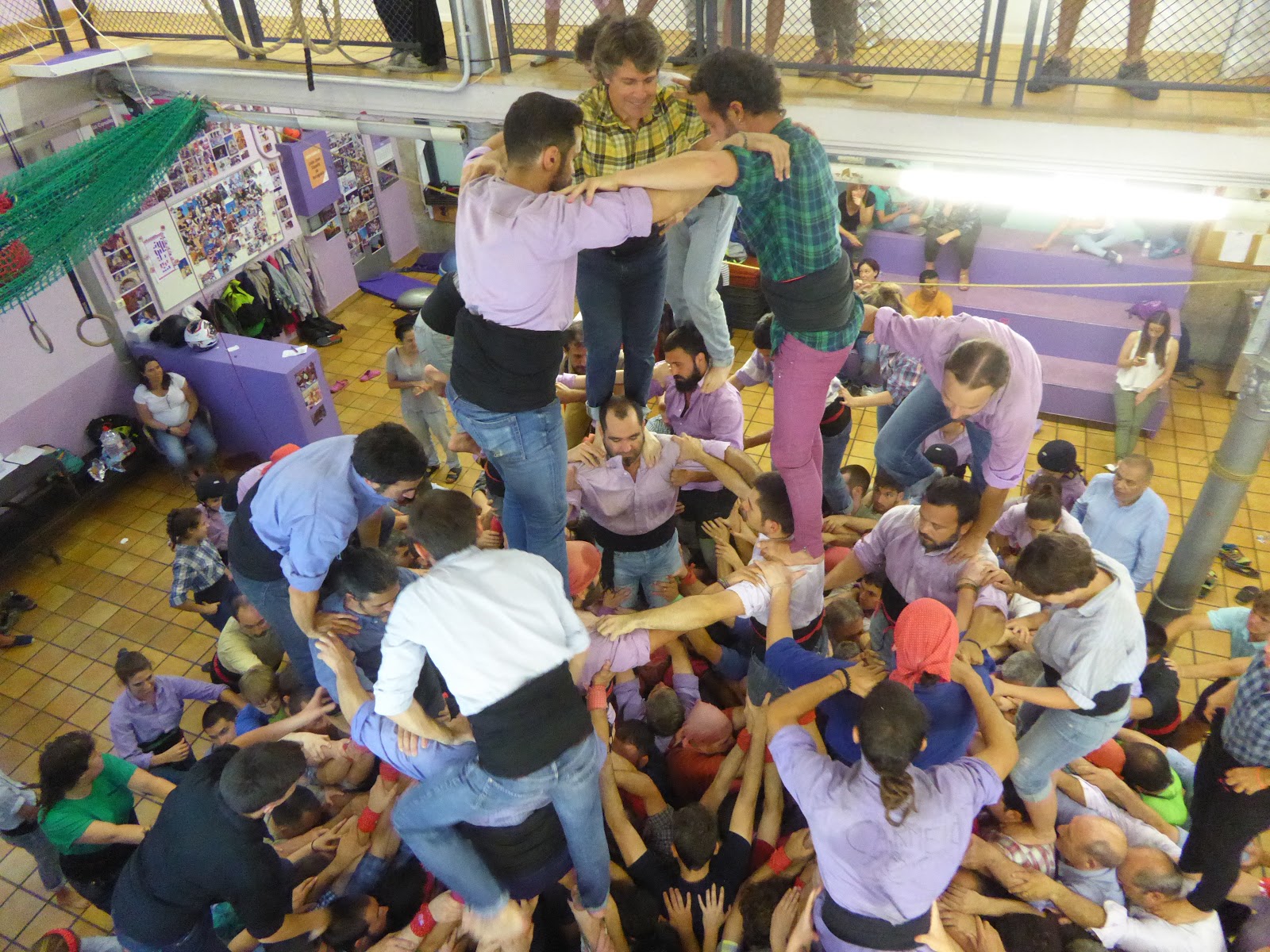
CASTELLS
(Human Castles / Towers)
UNESCO MASTERPIECE OF THE ORAL AND INTANGIBLE
HERITAGE OF HUMANITY

From the UNESCO declaration:
"Castells are human towers built by members of amateur groups (colles castelleres), usually as part of annual festivities in Catalonian towns and cities. The traditional setting is the square in front of the town hall balcony. The human towers are formed castelllers standing on the shoulders of one another in a succession of stages (between six and ten). Each level of the tronc, the name given to the second level upwards, generally comprises two to five heavier built men supporting younger, lighter-weight boys or girls. The pom de dalt - the three uppermost levels of the tower - comprises young children. Anyone is welcome to form the pinya, the throng that supports the base of the tower. Each group can be identified by its costume, particularly the colour of the shirts, while the cummerbund serves to protect the back and is gripped by castellers as they climb up the tower. Before, during and after the performance, musicians ply a variety of traditional melodies on a wind instrument known as a gralla, setting the rhythm to which the tower it built. The knowledge required for raising castells is traditionally passed down from generation to generation within a group, and can only be learned by practice."
From WIKIPEDIA
"The tradition of building castells originated the the Ball dels Valencians in Valls, near the city of Tarragona, first documented in 1712. In the 1980s, the inclusion of women in the formerly male-only discipline inaugurated the epoca d'or (golden age) of castells; the presence of women is credited with allowing castells to be built lighter and stronger, permitting the construction of previously undreamed - of 9 and 10 - storey castells.
A castell is considered a success when assembly and disassembly can be done in complete succession. The assembly is complete once all castellers have climbed into their designated places, and the enxaneta climbs into place at the top and raises one hand with four fingers erect, in a gesture said to symbolize the stripes of the Catalan flag. The enxaneta then climbs down the other side of the castell, after which the remaining level of castellers descend in highest to lowest order until all have reached safety."

Photo of a poster showing a Castell event and the throngs
of people attending the event.


I do not normally do this, but here is a link to a pictorial article in the ATLANTIC documenting the 26th annual Castell competition in 2016. The photos are remarkable.
https://www.theatlantic.com/photo/2016/10/building-human-towers-in-spain/502706/
The Jove "Colles Castelleres", one of many groups in Tarragon,
practicing their art at a regular Friday evening gathering.


The Monument als Castellers on the Rambla Nova, the main thoroughfare and linear park/esplanade in Tarragona memorializing the participants. As art, it is only passable, but it does indicate the importance of the tradition to Tarragona.
EL MERCAT CENTRAL DE TARRAGONA
Originally, Mercado Publico
(Central Market)
Josep M. Pujol i de Barbera,
1911-1915
Renovation, addition of lower level supermarket, and additional underground parking,
2011-2017


(Photo by others.)


STREET ART


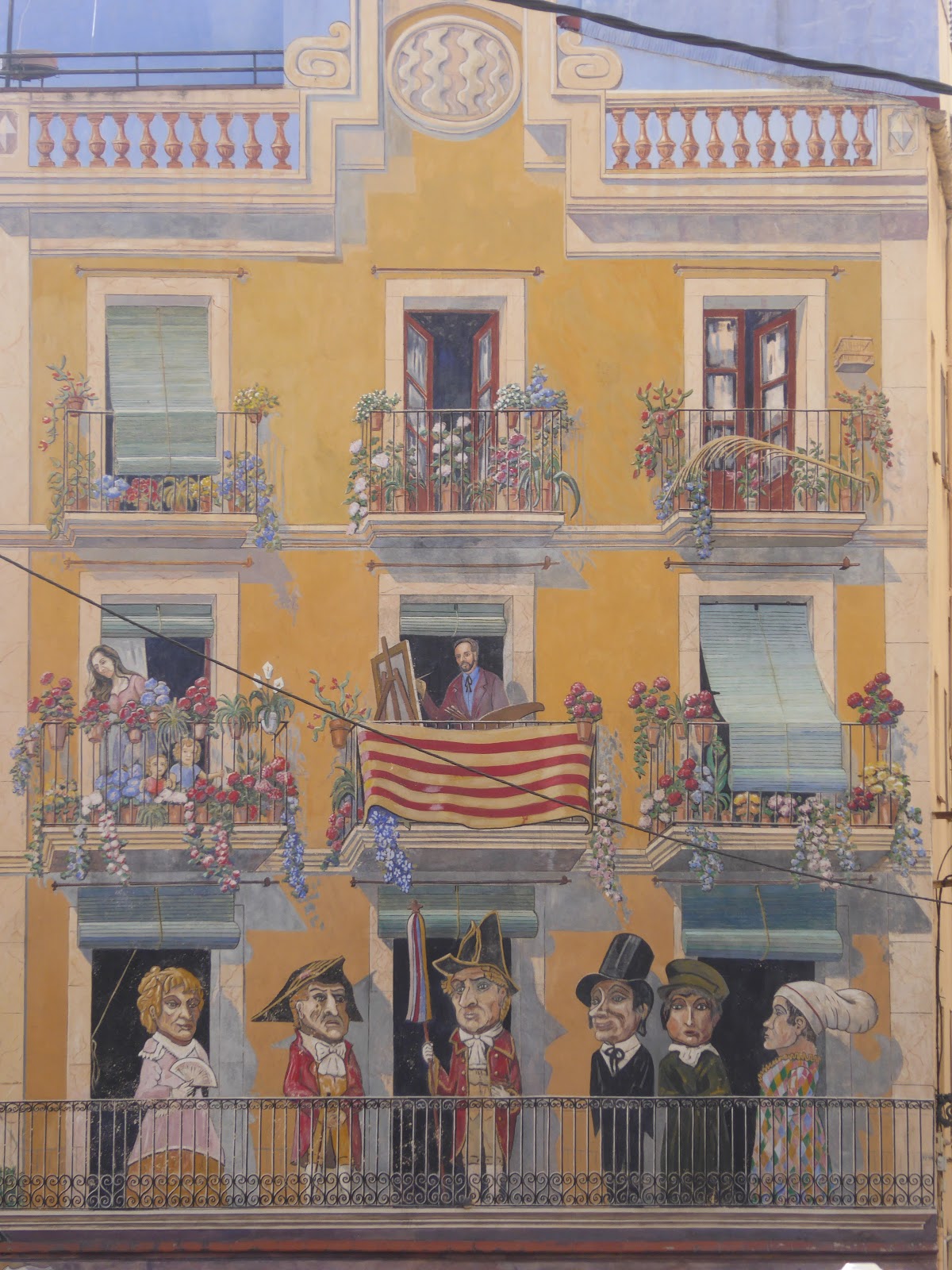


(Photo: courtesy of Tony Woodcock)


IIIIIIIIIIIIIIIIIIIIIIIIIIIII
Carrer de Compte
(Now known as: "Carrer del Pilons": Street of Pylons)
and the Sant Agapito Bis Festival
A grass-roots effort towards urban renewal in a section of the Old Town, Tarragona that started in 2005 has led to a yearly festival held on the first Saturday of July dedicated to an imaginary saint, during which time 57 bollards - which, along with re-paving was one of the first small steps in re-energizing the street - are hand-painted (re-painted) by local artists and aficionados. Some of the best street art in Tarragona has followed. Two of the city's better restaurants are also now located on the block.


IIIIIIIIIIIIIIIIIIIIIIIIIIIII

Agitprop at the local bus terminal to try to convince people to get out of
their cars and use the bus.


IIIIIIIIIIIIIIIIIIIIIIIIIIIII

_____________________________________
Copyright © 2017 Benjamin Clavan
No comments:
Post a Comment